OUR MISSION
The Changing Landscapes Initiative is a Smithsonian-led program that bridges the gap between scientists and communities. CLI scientists work alongside community members to evaluate the impacts of land use change on wildlife, ecosystem services and community health. Its mission is to combine research with community wisdom to help secure a vibrant and healthy future for people and wildlife.
This Month in Conservation Science | January 2024
Read the Newsletter
Recent Collaborations
This Month in Conservation Science | January 2024
Read the Newsletter
CLI collaborates with scientists from a variety of agencies, organizations, and academic institutions to investigate the potential impacts of land use change on ecosystem services including: water quality, viewshed quality, pollinator abundance, forest health, and more. Check this page for the latest news and updates about ongoing research efforts and collaborations.
Where We Work
This Month in Conservation Science | January 2024
Read the Newsletter
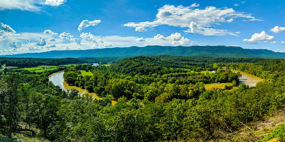
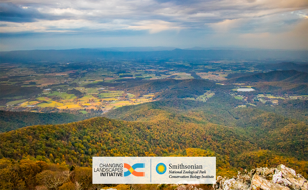
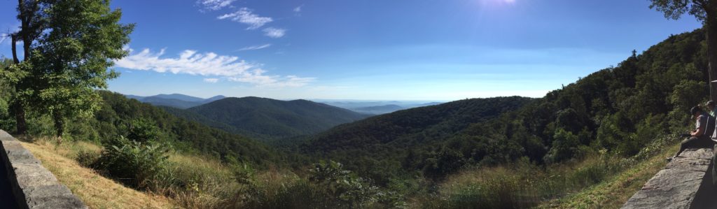
CLI focuses on a 15-county region in Northwestern Virginia encompassing Shenandoah National Park and bordering George Washington National Forest. Northwestern Virginia comprises forests, meandering rivers, rolling mountains, grasslands, farms, and historic towns like Charlottesville. This region is territory of the Monacan tribe, host of several Green Book sites, and full of Civil War history. It is a biodiverse landscape that hosts a number of charismatic plant and animal species and provides opportunities for agriculture, recreation, and tourism — all of which uphold thriving local cultures and economies and create a unique sense of place. Click on the circles in the map of the CLI study area below to discover some of the key defining features in this region.
A Changing Landscape
This region is also experiencing rapid change driven by its proximity to cities like Washington, D.C. and Baltimore where a rising population has sparked significant pressure for development in some of the region's rural and agricultural areas. Move the slider below to see the difference in the scale and density of human development between 1984 (lefthand side) and 2016 (righthand side) in the Ashburn, Virginia area around Dulles airport.
This Month in Conservation Science | January 2024
Read the Newsletter
Northwestern Virginia is at a crossroads in which land planning decisions must strike a balance between accommodating growth and preserving the region’s unique natural, cultural, and historical value.
As development expands into historically rural and agricultural areas, impacts to wildlife habitat, water quality, and scenic views have already been found in some parts of the region.
Land use and planning decisions that we make today will influence the state of our future, and many decisions are irreversible. In order to preserve the benefits we derive from this landscape, we need to understand what land use change may come and how this can affect our communities and the natural world. To do this well, we must use the best information available today to prepare for the future.
How can communities like Northwestern Virginia meet their current and future needs without compromising the region’s rural character and bountiful resources?
Community-Driven Solutions
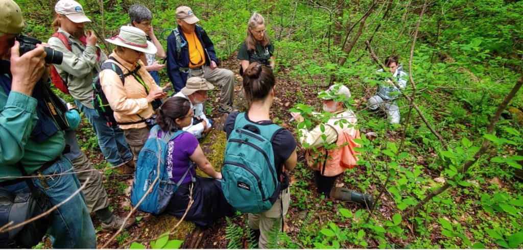
In 2016, scientists from the Smithsonian’s Changing Landscapes Initiative collaborated with community leaders from across the region to answer that question. Together, they worked to develop a set of potential future scenarios for Northwestern Virginia.
This Month in Conservation Science | January 2024
Read the Newsletter
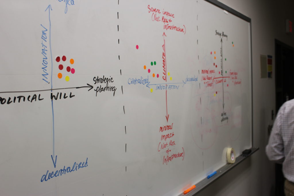
CLI researchers then combined the community-provided knowledge with scientific data and completed a rigorous analysis to develop landscape maps which show what each scenario could look like in 2060.
The above map shows what two of the land-use scenarios could look like in 2060—from a bird’s eye view. While the maps are not meant to serve as predictions of the future, they do give communities a probable peek into the future to help guide their decision-making.
By zooming into the maps and comparing how the composition of the landscape differs across the future scenarios, one can envision the potential implications of land use changes. This capability also helps county and city-level planners coordinate their local decisions within the context of the larger landscape.
By working together, CLI scientists and community leaders can create and share these maps and ecosystem service analyses with county planners, conservation advocates, and community leaders. With this information, communities can make informed decisions to preserve the region’s rural landscape, ecosystem services, and community wellbeing well into the future.
Who We Are
Our team is united by a shared belief that effective conservation comes down to a key factor: people, and their relationship with the land. That's why, above all, our scientific research is led and inspired by the local community. If you're interested in collaborating with the CLI, or just want to learn more, please click on the bios below.
This Month in Conservation Science | January 2024
Read the Newsletter

CLI Founder & Advisor
Spatial Analyst & Lab Manager

CLI Program Lead
Acknowledgements
This Month in Conservation Science | January 2024
Read the Newsletter
This program was made possible thanks to generous support from the Smithsonian’s Environmental Research Center, Piedmont Environmental Council, the Appalachian Trail Conservancy, USGS, the Shenandoah National Park Trust, the Shenandoah Valley Network, Virginia Tech, the Virginia Native Plant Society, the Washington Biologists’ Field Club, Working Land & Seascapes, and the researchers and citizen scientists at eMammal and Virginia Working Landscapes.