Forest Cat, City Cat
Landscape Maps and Remote Camera Data Reveal Two Different Stories About Two Similar Mammals
Imagine you’re hiking in the woods in a large national park. Something rustles in the bushes. Do you think you would you be more likely to see a bobcat or a domestic cat emerge from that spot?
Now, imagine you’re walking near a residential area in the suburbs, and something stirs near a neighbor’s house. Which animal do you expect to see now?
Landscape ecologists at the Changing Landscapes Initiative (CLI) partnered with conservation ecologist and mammologist Dr. Michael Cove to examine this question in more detail. They wanted to find out what factors influenced where different mammal species are found in northern Virginia.
The researchers used what they found to create maps that showed where these species live now and where they might live in a future where land use in the region has changed. By comparing the different maps, the team had valuable data to share with local landowners and decision makers.
Their research centered around the CLI’s primary study area (see interactive map below)—a large portion of Northern Virginia that surrounds Shenandoah National Park and borders George Washington National Forest. The variety of land cover here—including forests, rivers, mountains, grasslands, and farms—make up a biodiverse landscape that is home to many local plant and animal species. The team narrowed their focus to five species that live in this landscape, but here we will focus on comparing the ranges of bobcats (Lynx rufus) and domestic cats (Felis catus).
A Tale of Two Cats: Comparing Two Species
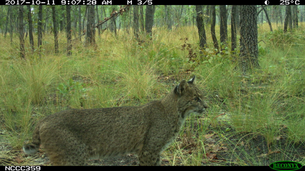
Bobcats are small wildcats that can be found from Mexico to southern Canada, and they are the only wildcat species in Virginia. These skilled predators feed largely on small-to-medium sized mammals—many of which are agricultural pests—keeping their populations in check. While bobcat numbers across the country have recovered from overhunting in the early 1900s, to the point they are considered to be a species of “least concern” by the International Union for Conservation of Nature (IUCN), habitat loss is now a growing concern for many populations.
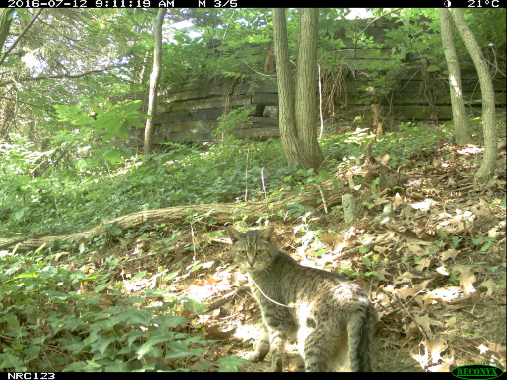
When it comes to domestic cats, we’re all familiar with the fuzzy pets that we love and invite into our homes. However, free-roaming outdoor cats can have a significant impact on local biodiversity. Free-roaming domestic cats in the United States kill some 2.4 billion birds and 12.3 billion mammals each year. This concern has not gone unnoticed by conservation scientists, and has lead to efforts, like the DC Cat count, that gather robust data sets on cat numbers in and around urban areas.
Plotting the Cats’ Whereabouts
To create species distribution maps (maps that show where a species is expected to be found), the team needed data from a broad area and from a variety of regional habitats. Thanks to contributions from researchers and community scientists, like those at Virginia Working Landscapes, who submitted images to the Smithsonian’s eMammal archive for camera trap research projects, the CLI team were able to use camera trap data from 1,591 different sites in and around the region.
By looking at what species showed up on which cameras and comparing those locations to each site’s landscape characteristics (e.g., how much forest cover was in the surrounding area or how far the camera was from development), the team could look for patterns that helped explain how different land uses affect the probability of seeing these animals.
For the bobcats, the team found a strong positive association with locations that had large amounts of forest surrounding them, and a negative association to being close to crops, development, or roads. This means that bobcats were more likely to be found within dense forests, especially in large, protected areas away from human structures.
On the other hand, domestic cats had a negative association to living in areas with core forest habitat and had a positive association with increased human development and proximity to roads.
Mapping Mammal Locations Now and into the Future
The above interactive maps compare bobcat and domestic cat ranges in 2011 (left side of slider) and projected in 2060 (right side of slider) from a possible future scenario when planners reactively respond to a population increase by allowing new development to spread away from city centers.
Knowing the positive or negative influence that each landscape characteristic had on these species, the team could apply those associations to a land use map and show the probability of finding the species across the entire region. That technique could work with the current landscape, or the CLI’s future scenario landscapes, because both show the same types of land use.
You can see examples of the present-day and future-scenario-based maps in the interactive maps shown above. On the left side of the map, you can see what bobcat and cat distributions look like as of 2011. On the right side of the maps, you can see what bobcat and cat distributions may look like in a future scenario in 2060 that CLI developed with local stakeholders. In the future scenario shown in the above map, planners reactively respond to a significant increase in population by allowing new development to spread away from city centers.
In this future scenario, bobcats are projected to lose 612 km2 of their total range. This would further isolate the species to large, protected areas like Shenandoah National Park and George Washington National Forest.
On the other hand, domestic cats are projected to do very well with the prospect of increased human population and sprawl. These results project that outdoor cats will gain nearly 3,500 km2 in their total range.
For every tested scenario, cat ranges were projected to increase, and bobcat ranges were projected to decrease, even if the human population growth is slow. However, the scenarios where planning was strategic and focused new development near city centers reduced cat range expansion and bobcat range loss by more than 40%.
Results and Analysis
The results of this research are helpful for land managers, landowners, and regional planners in several ways. They highlight the importance of large, protected areas like national parks and forests as critical strongholds for larger species like bobcats and bears. For forested areas outside of those protected spaces that may be closer to human development, strategic planning decisions can benefit small mammals such as foxes and even the occasional bobcat.
These insights wouldn’t be possible without the local landowners and other stakeholders that engaged with the research team and shared their knowledge at the beginning of the CLI program. This information can now be sent back to the community so they can make informed decisions about their land and about supporting future land use changes in their region. The individual and region-wide actions taken today can ensure that the ecosystems in our landscapes will support communities and wildlife for years to come.
The Changing Landscapes Initiative is a Smithsonian-led program that combines research with community wisdom to help secure a vibrant and healthy future for people and wildlife. CLI staff and collaborators conduct research to understand the current and future impacts of land use decisions on forest connectivity, wildlife migration and biodiversity, among other essential ecosystem services.